![](/images/other/stat-length.png)
![Randonnée A pied Palazzuolo sul Senio - IT-711 - Photo](https://media.geolcdn.com/t/1900/400/278fdf13-3a3e-41ef-a779-fea8db6fbb36.jpeg&format=pjpeg&maxdim=2)
IT-711
SityTrail - itinéraires balisés pédestres
Tous les sentiers balisés d’Europe GUIDE+
![Longueur](/images/other/stat-length.png)
Longueur
3,1 km
![Altitude max](https://static1.geolcdn.com/siteimages/upload/files/1508320355ic_sort_altitude_max_24dp.png)
Altitude max
625 m
![Dénivelé positif](https://static1.geolcdn.com/siteimages/upload/files/1508320355ic_sort_den_pos_24dp.png)
Dénivelé positif
166 m
![Km-Effort](/images/other/stat-length.png)
Km-Effort
4,8 km
![Altitude min](https://static1.geolcdn.com/siteimages/upload/files/1508320355ic_sort_altitude_min_24dp.png)
Altitude min
465 m
![Dénivelé négatif](https://static1.geolcdn.com/siteimages/upload/files/1508320355ic_sort_den_neg_24dp.png)
Dénivelé négatif
16 m
![Boucle](https://static1.geolcdn.com/siteimages/upload/files/16400158638029165_repeat_loop_refresh_sync_direction_icon.png)
Boucle
Non
Balise
Date de création :
2022-02-15 05:06:14.137
Dernière modification :
2022-03-01 02:55:26.743
![A pied](https://static1.geolcdn.com/sitytour/trail-icons/100.png)
1h05
Difficulté : Facile
![Scannez ce code QR pour ouvrir la randonnée dans l'application SityTrail](https://capi.geolives.com/qq0zvz2zws4bq2lad0pu/sitytour/trails/3115605/qr.png?size=200)
Application GPS de randonnée GRATUITE
À propos
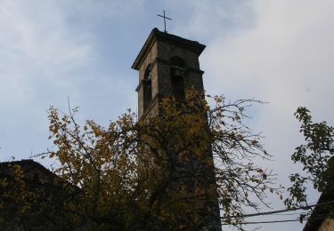
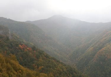
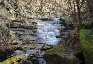
Randonnée A pied de 3,1 km à découvrir à Toscane, Firenze, Palazzuolo sul Senio. Cette randonnée est proposée par SityTrail - itinéraires balisés pédestres.
Description
Randonnée créée par CAI Imola.
Relation maintened by Gabriele Sani (CAI-FA)
Symbole: 711 on white red flag
Site web: http://www.cai-imola.it/
Localisation
Pays :
Italie
Région :
Toscane
Département/Province :
Firenze
Commune :
Palazzuolo sul Senio
Localité :
Unknown
Départ:(Dec)
Départ:(UTM)
695149 ; 4885078 (32T) N.
Commentaires
Randonnées à proximité
![Randonnée A pied Firenzuola - Sorgenti di Firenze Trekking - Anello 15: Sui monti di Moscheta - Photo](https://media.geolcdn.com/t/375/260/933cc0d5-e5eb-4971-b1fe-de6532420af3.jpeg&format=jpg&maxdim=2)
![A pied A pied](https://static1.geolcdn.com/sitytour/trail-icons/100.png)
Sorgenti di Firenze Trekking - Anello 15: Sui monti di Moscheta
A pied
Facile
Firenzuola,
Toscane,
Firenze,
Italie
![](/images/other/stat-length.png)
10 km | 16,2 km-effort
3h 40min
![](https://static1.geolcdn.com/siteimages/upload/files/16400158638029165_repeat_loop_refresh_sync_direction_icon.png)
Non
![Randonnée A pied Firenzuola - Sorgenti di Firenze Trekking – Anello Principale: Tappa 1 - Photo](https://media.geolcdn.com/t/375/260/484a73ee-a64f-4bc5-b576-0dd44087b5af.jpeg&format=jpg&maxdim=2)
![A pied A pied](https://static1.geolcdn.com/sitytour/trail-icons/100.png)
Sorgenti di Firenze Trekking – Anello Principale: Tappa 1
A pied
Difficile
Firenzuola,
Toscane,
Firenze,
Italie
![](/images/other/stat-length.png)
19 km | 32 km-effort
7h 20min
![](https://static1.geolcdn.com/siteimages/upload/files/16400158638029165_repeat_loop_refresh_sync_direction_icon.png)
Non
![Randonnée A pied Palazzuolo sul Senio - IT-41 - Photo](https://media.geolcdn.com/t/375/260/6a638721-55c1-4f6d-8245-b9d584d98964.jpeg&format=jpg&maxdim=2)
![A pied A pied](https://static1.geolcdn.com/sitytour/trail-icons/100.png)
IT-41
A pied
Facile
Palazzuolo sul Senio,
Toscane,
Firenze,
Italie
![](/images/other/stat-length.png)
6,8 km | 12,2 km-effort
2h 46min
![](https://static1.geolcdn.com/siteimages/upload/files/16400158638029165_repeat_loop_refresh_sync_direction_icon.png)
Non
![Randonnée A pied Palazzuolo sul Senio - IT-607A - Photo](https://media.geolcdn.com/t/375/260/cb85535f-afff-433b-a0eb-9af819252ed5.jpeg&format=jpg&maxdim=2)
![A pied A pied](https://static1.geolcdn.com/sitytour/trail-icons/100.png)
IT-607A
A pied
Facile
Palazzuolo sul Senio,
Toscane,
Firenze,
Italie
![](/images/other/stat-length.png)
4 km | 5,8 km-effort
1h 18min
![](https://static1.geolcdn.com/siteimages/upload/files/16400158638029165_repeat_loop_refresh_sync_direction_icon.png)
Non
![Randonnée A pied Palazzuolo sul Senio - IT-741 - Photo](https://media.geolcdn.com/t/375/260/8ec91149-73e4-4168-9bc3-821e058f9a3b.jpeg&format=jpg&maxdim=2)
![A pied A pied](https://static1.geolcdn.com/sitytour/trail-icons/100.png)
IT-741
A pied
Facile
Palazzuolo sul Senio,
Toscane,
Firenze,
Italie
![](/images/other/stat-length.png)
7,7 km | 13,6 km-effort
3h 5min
![](https://static1.geolcdn.com/siteimages/upload/files/16400158638029165_repeat_loop_refresh_sync_direction_icon.png)
Oui
![Randonnée A pied Firenzuola - IT-713 - Photo](https://media.geolcdn.com/t/375/260/2c890dd7-6d2b-4541-90b2-c6f0209da9ee.jpeg&format=jpg&maxdim=2)
![A pied A pied](https://static1.geolcdn.com/sitytour/trail-icons/100.png)
![Randonnée A pied Borgo San Lorenzo - IT-36A - Photo](https://media.geolcdn.com/t/375/260/933cc0d5-e5eb-4971-b1fe-de6532420af3.jpeg&format=jpg&maxdim=2)
![A pied A pied](https://static1.geolcdn.com/sitytour/trail-icons/100.png)
IT-36A
A pied
Facile
Borgo San Lorenzo,
Toscane,
Firenze,
Italie
![](/images/other/stat-length.png)
4,9 km | 7,4 km-effort
1h 40min
![](https://static1.geolcdn.com/siteimages/upload/files/16400158638029165_repeat_loop_refresh_sync_direction_icon.png)
Non
![Randonnée A pied Palazzuolo sul Senio - Anello di Campanara - Photo](https://media.geolcdn.com/t/375/260/88b3933a-0b25-473f-92c1-9d5ce278b334.jpeg&format=jpg&maxdim=2)
![A pied A pied](https://static1.geolcdn.com/sitytour/trail-icons/100.png)
Anello di Campanara
A pied
Moyen
Palazzuolo sul Senio,
Toscane,
Firenze,
Italie
![](/images/other/stat-length.png)
15,6 km | 26 km-effort
5h 50min
![](https://static1.geolcdn.com/siteimages/upload/files/16400158638029165_repeat_loop_refresh_sync_direction_icon.png)
Oui
![Randonnée A pied Palazzuolo sul Senio - Giro dell'Altello - Photo](https://media.geolcdn.com/t/375/260/3930022e-d1a8-4a47-8f6c-bcce356ae891.jpeg&format=jpg&maxdim=2)
![A pied A pied](https://static1.geolcdn.com/sitytour/trail-icons/100.png)
Giro dell'Altello
A pied
Facile
Palazzuolo sul Senio,
Toscane,
Firenze,
Italie
![](/images/other/stat-length.png)
8,4 km | 13,8 km-effort
3h 7min
![](https://static1.geolcdn.com/siteimages/upload/files/16400158638029165_repeat_loop_refresh_sync_direction_icon.png)
Oui